Faultlines
These are the landscapes I grew up with, the land I know and love as my place in the world. But I have another reason for this trip: I want to reacquaint myself with the topography around our Alpine Fault — the longest natural straight line on earth, over 600 kilometres of fault line running between the Australian and Pacific tectonic plates. I want to be reminded of the sheer magnificence of this whenua, but also the potential for these mountains to tremble and break apart.
Which is highly likely in the very near future. The science is unequivocal: over the last 8000 years, there has been a major earthquake on the Alpine Fault roughly every 300 years. The last one? 1717. Do the maths.
Geologists certainly didn’t foresee the Darfield earthquake of September 2010— the last event on that fault line was 20,000 years ago. No one predicted the intensity of the quake that devastated Christchurch in February 2011, or the scale of the one that shook Kaikōura in 2016. But as a result of research over the last two decades, we now know that there is a 75 per cent likelihood of an earthquake on the Alpine Fault in the next 50 years, and an 82 per cent chance it will be over eight on the Richter scale. This one — AF8, as it’s called — we can prepare for.
And it’s going to be a doozy. Take the intensity of standing above the epicentre of the Christchurch February 2011 quake, which lasted just 30 seconds. Now imagine even more intense shaking continuing for two to four minutes, travelling the length of the Southern Alps.
This isn’t hyperbole. It’s not scaremongering, although it’s pretty scary. This is simply the reality that our stunningly beautiful country owes its very existence to one tectonic plate pushing up against another. It’s resulted in the splendour of the Southern Alps. But the corollary is that, every now and then, the force and tension along the plate boundary releases a massive earthquake.
This story isn’t just about the science. It’s as much about he tangata, the people and communities that will be most directly affected. After all, New Zealand is in the midst of a global pandemic, with tourist towns on their knees. Every other day we’re confronted with the realities of global warming — storms, droughts, floods, wildfires. Can we — as individuals, communities, as a nation — take in the reality of yet another disastrous scenario, one that would be significantly more life-changing than Covid-19? Can we prepare for a catastrophe that would bring much of New Zealand to a grinding halt?
It was midwinter 2017 in Queenstown, a few centimetres of snow falling outside, when the power at our place suddenly went out. The dark was one thing, the cold quite another. So I suggested to my daughter that we head into town. I’d seen the advertising for a talk that night about a major earthquake. I hadn’t planned on attending, but I knew the Memorial Centre would be warm. Amazingly, the hall was full of familiar faces: it seemed half of Queenstown was there.
The first speaker was Dr Caroline Orchiston, an associate professor at Otago University in her early 40s with a clear and personable manner. Within a few minutes she had me sitting straight-backed in my chair — this was no standard earthquake drill.
Orchiston sketched out a riveting mini-history of the science of the Alpine Fault. (You can learn more about the science here.)
In 2004, scientists Kelvin Berryman and Ursula Cochran travelled to a site at Hōkurī Creek in northern Fiordland. A flood had washed the escarpment clean, revealing layers of peat and sediments in a distinctive striped pattern. They took samples from every layer back to their lab. What they eventually confirmed was extraordinary: the stratified riverbank has a record of almost 8000 years of seismic history. There was almost nothing like it on Earth. And every one of those stripes on the slope corresponded to a major earthquake that had occurred, on average, every 300 years (‘major’ meaning magnitude eight).


Orchiston went on to describe what sounded like a dystopian movie: landslides causing a tsunami-like wave known as a ‘seiche’ on Lake McKerrow or Milford Sound. But it was the next graphic that brought it home: a computer animation of the quake in real time, starting in Fiordland and increasing in intensity as it travelled up the island. And the reality dawned on me: the entirety of Te Waipounamu/the South Island would be hit very, very hard.
The last recorded Alpine Fault earthquake had been dated to 1717, Orchiston noted. You could see everyone in the room mentally adding 300 and exchanging horrified glances. Orchiston went on to describe what sounded like a dystopian movie: landslides causing a tsunami-like wave known as a ‘seiche’ on Lake McKerrow or Milford Sound. But it was the next graphic that brought it home: a computer animation of the quake in real time, starting in Fiordland and increasing in intensity as it travelled up the island. And the reality dawned on me: the entirety of Te Waipounamu/the South Island would be hit very, very hard.
Her office is within Otago University’s Centre for Sustainability, a soft-sounding umbrella term for addressing all the hazards out to get us — climate change, biodiversity threats and major earthquakes. Her focus is on community preparedness and resilience, particularly in areas of “high seismic risk”.
Orchiston first became aware of what the Alpine Fault was capable of while doing her PhD in geology in the mid-1990s. A lecturer was explaining those startling timelines — a major quake every 300 years, the last one in 1717.
But it wasn’t until 2014, after the evidence about the frequency of AF8 ruptures had been peer-reviewed and deemed unequivocal, that the chasm between science and community began to be bridged. Admittedly, the Canterbury earthquakes diverted scientists’ attention for a couple of years — but it also gave them the leverage and funding to alert the public to the threat represented by AF8.
In 2015, Orchiston initiated meetings with Civil Defence managers on the West Coast, but soon realised that the awareness campaign had to be much bigger. She emailed 30 Alpine Fault scientists around the country, proposing a conference to “thrash out a scenario”. The AF8 campaign was born.
Most people, Orchiston says, have been grateful for the warning. “I did have one farmer in Whataroa who came up to me, saying, ‘Why are you coming here to talk about this stuff? I’ve been trying to sell my farm for seven years. You’re only making it harder.’ But he stayed for the whole presentation. There was a great supper afterwards — everyone had brought a plate.”


The Alpine Fault line runs from just north of Milford Sound all the way to Maruia near Lewis Pass. There it connects with the Marlborough Fault System, including the faults that ruptured during the Kaikōura earthquake. The seismic waves will ripple out and affect just about every area in the South Island, potentially all the way to Wellington. The scientists forecast that a rupture could be up to magnitude 8.2. But this is a measure of “seismic energy released”, not damage or shaking. More relevant, perhaps, is the Mercalli Scale, a measure of the intensity of damage in any one place — related to how far away the faultine is and what the ground beneath your feet is made of.
The most intense shaking will be on the West Coast, within 10 kilometres of the fault. “Rocks and landslides will be coming down off the Alps, so if you’re anywhere near the mountains it’ll be very loud,” says Orchiston. “We’re talking horizontal movement of up to eight metres.” The advice "drop, cover and hold" still very much applies, but given the intensity of this earthquake, Orchiston says, you may be unable to stand up.
“If you try and go to your kids you’re more than likely to hurt yourself,” she explains matter-of-factly. But in the same breath, she adds, “Whenever I say that, people say, ‘but I’d head to my kids’, and I say, ‘yes, I have to be honest with you, I would too. Or at least I’d try’.”
And so the overwhelming message from scientists and Civil Defence is: get ready. As Orchiston puts it, “The conversation’s shifted from, ‘Oh, this is a big scary thing, what are we going to do?’ to ‘Okay, people have got a good understanding of the risk. What can we do as a community to deal with that?’”
The Lindis is clear. The grader’s been through, the road is gritted and, though icy in places, the drive is easy. These soft yet steep hills are comforting, gleaming in the early-morning sun. The first power pylon comes into view near the saddle, the lines stretching down the valley towards Omarama and on to the Waitaki Valley hydroelectric power stations — Lake Pukaki, Benmore and Aviemore dams. Approaching the canal before Lake Pukaki, those power lines hang ominously low. Glancing down the length of the canal’s cobalt-blue waters, I wonder at the strength of the walls, the pylons, the dam itself.


At the AF8 presentation I attended in Queenstown, Orchiston’s colleague, Canterbury University’s Professor Thomas Wilson, spoke about the “secondary hazards” in the aftermath of an earthquake on the Alpine Fault. These include landslides, rivers being diverted and dammed, and the siltation of rivers and hydro schemes. But the most urgent, he says, is the inevitable loss of electricity.
It could take at least two days to re-erect a pylon, Wilson says, depending on aftershocks, the availability of personnel and the safety of the surrounding terrain. More sobering is that the entire electricity grid across the South Island could fail. Which means the transmission grid in the North Island — which depends on the South — could go out as well, plunging the whole country into blackout.
Engineers talk about something called ‘black start’. If every power station in the South Island goes down, or has to be turned off to protect the turbines, it’ll be a very slow restart — like a series of cascading dominoes in reverse. As Andrew Renton, senior principal engineer at Transpower, explains, only a few power stations are able to start without electricity. Once pylons and lines have been restored and checked, one or more of those power stations with a back-up power source will switch on. “Little by little, sectors of the grid will come back to life.” Renton estimates it would take a small sector (say, Roxburgh to Dunedin) around eight hours to get up and running, and probably 18 hours to bring the rest of the South Island back on. He believes blackout across the entire country is possible but unlikely. However, some regions would certainly be ‘islanded’ — the technical term for an area being isolated without power. The most obvious candidate: the West Coast.
The consequences of having no electricity, for several hours, several weeks or more, are alarming. There’s the urgent need for power for medical equipment, food supplies and heating. But the most critical, according to Tom Wilson, is the loss of power for telecommunications, which he says will be the biggest challenge of all.
Across the South Island, many communities are now preparing in earnest. The AF8 website has a great list of what you need at home, but as Orchiston points out, you could be anywhere when the quake hits. “If I’m driving to the coast, I always check I’ve got a sleeping bag in the car, plenty of drinking water, food, good walking boots, and even a PLB (personal locator beacon).” Check. I’ve got all of that stashed in the boot and glovebox.
It’s a long day’s drive to Christchurch. Suddenly the new motorways begin, elevated four lanes tracking across town. Traffic slows to a crawl navigating the pot-holed roads in the eastern suburbs. A decade on, many are still struggling here, the wastelands of the Red Zone a stark reminder of a place where no house should ever have been built. It was a swamp for chrissakes. Earthquake strengthening continues — but are we still building on swamps?
According to Mike Jacka, senior geotechnical engineer for Tonkin + Taylor environmental and engineering consultancy in Christchurch, the answer is a qualified yes, not just in Christchurch but all around New Zealand. "Often that's the only available land," Jacka explains. "But that's okay as long as you do it properly. And we’re now doing a much better job of doing it properly.”
The pain of the last 10 years in Christchurch — lost lives, lost communities, lost direction and dislocation, of sheer miserable exhaustion — is a sober reminder that what comes after the earthquake can be worse than the actual event. Orchiston believes that when the Alpine Fault ruptures, Christchurch will feel it, but “nowhere near as intensely as on the West Coast”, with liquefaction unlikely. Small mercies.
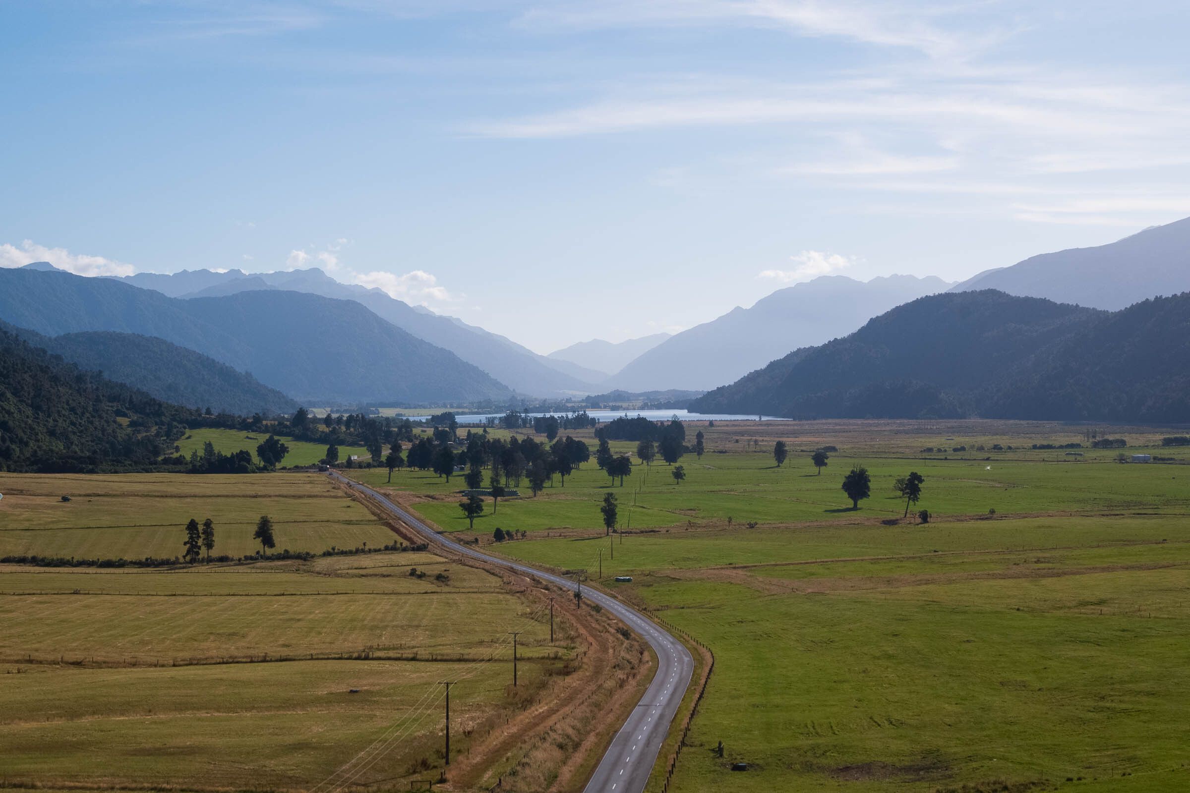
The high-pressure system of clear blue skies is still with us, the white mountains like a beacon as I drive west. It’s less than 40 minutes to the benign landscape around Darfield, where in September 2010 whole paddocks and roads had gaping fissures and houses were sheared apart. Another 15 minutes and I’m heading through Springfield, a key staging post for Civil Defence at the base of the Alps. I’m soon climbing Porters Pass, seeing the steep rock falls to my left and the temperature gauge drop. It would be one thing if AF8 struck in summer, quite another if it happened in the middle of winter. You’d need that warm sleeping bag.
From the top of Porters Pass, the road descends towards Lake Lyndon. As children, we donned ice skates here, diffidently making our way to the middle of the lake in woollen hats and mittens, grinning madly. The ice was solid, there was no risk of falling through. Midwinter 2021, there’s not a skerrick of ice to be seen.
Those pylons stand sentinel again, a major conduit for electricity through to the West Coast, the early-morning sun glinting off every line. The mountains are smothered in fresh snow, white and wonderful.
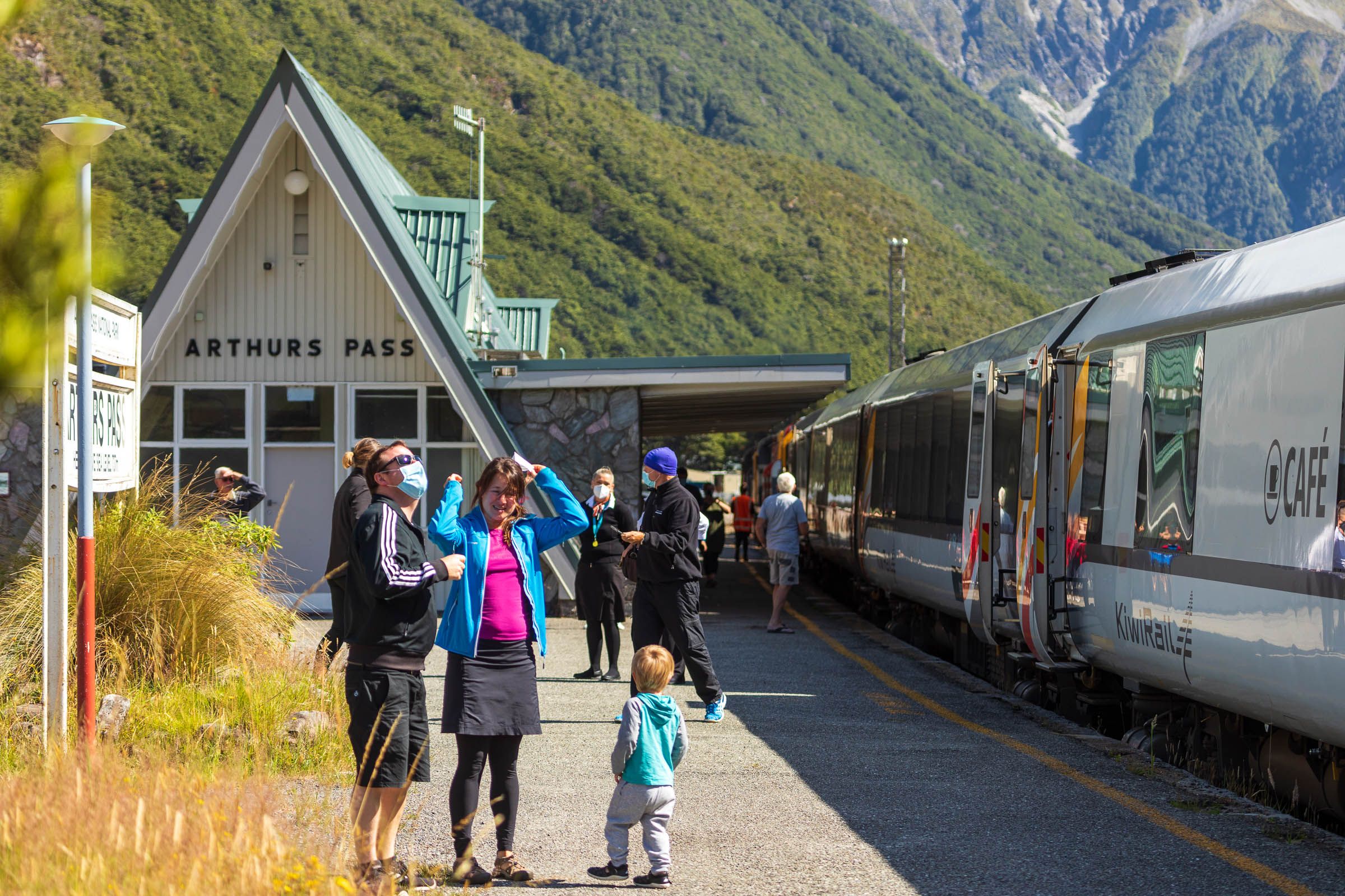
“If it’s winter and the ski fields are operating, we’ll have hundreds of avalanches, potentially hundreds of people under avalanches.” This from Al Lawn, manager of Civil Defence for Selwyn District. Lawn’s had to think long and hard about how to prepare for every possible scenario when AF8 ruptures. “We’ve got six ski fields we’d need to evacuate. We might have busloads of kids on school trips up at Cave Stream, or a TranzAlpine train packed with up to 300 tourists.”
When you sit down and talk to Civil Defence teams, the somewhat abstract science of the Alpine Fault becomes very real, very quickly. Al Lawn came from Fire and Emergency New Zealand (FENZ). He’s dealt with his fair share of wildfires and floods, and witnessed the chaos following the Christchurch quake. Anticipating another major seismic event means moving up a notch in terms of preparedness. The first priority is the Canterbury high country.
Lawn says they have an understanding with the helicopter companies. “They’ll come directly to our base in Rolleston, and we’ll then head straight to the high country to survey the damage. We’ll be airborne in under two hours. Elsewhere, people will simply have to shelter, make-do in situ.”
‘Making-do’ requires extensive preparation. Selwyn District has initiated an online portal, Selwyn Gets Ready, where households can provide information on their resources — if they have generators, four-wheel-drive vehicles, quad bikes, VHF radio or a satellite phone. Of more than 26,766 households in Selwyn District, more than 10,000 have signed up, over 65,000 people. A significant number are farmers, all reasonably self-sufficient. “If Chorus has a substation that goes down that needs a 10 kVA generator, there might be a local cockie who can help,” says Lawn.
Seventeen districts in New Zealand have a similar system. But Selwyn District, Lawn suggests, has had greater uptake because many residents have already been through the Canterbury earthquakes. They’re still working on encouraging more people to sign up — “the folk who don’t see the threat and those who are just too busy with life, young families in larger towns, or those who don’t live near a coast where there is a tsunami threat or in the high country where weather is often extreme”.
The landmarks come and go on the road towards Arthur’s Pass. There’s the Cass railway station, made famous by artist Rita Angus and a much-needed shelter late at night before tramping trips; the ‘Waimak’ bluffs, wire netting holding back the persistent rock falls; the approach to the one-way Bealey Bridge, the chocolate-box view up the Waimakariri; the stone shelter at Klondyke Corner; and finally the beech forest lining the road, each tree leaning this way or that, before the sunshine of Arthur’s Pass Village. In the few minutes it takes a rupture to travel the length of the Alps, this entire landscape could be transformed.
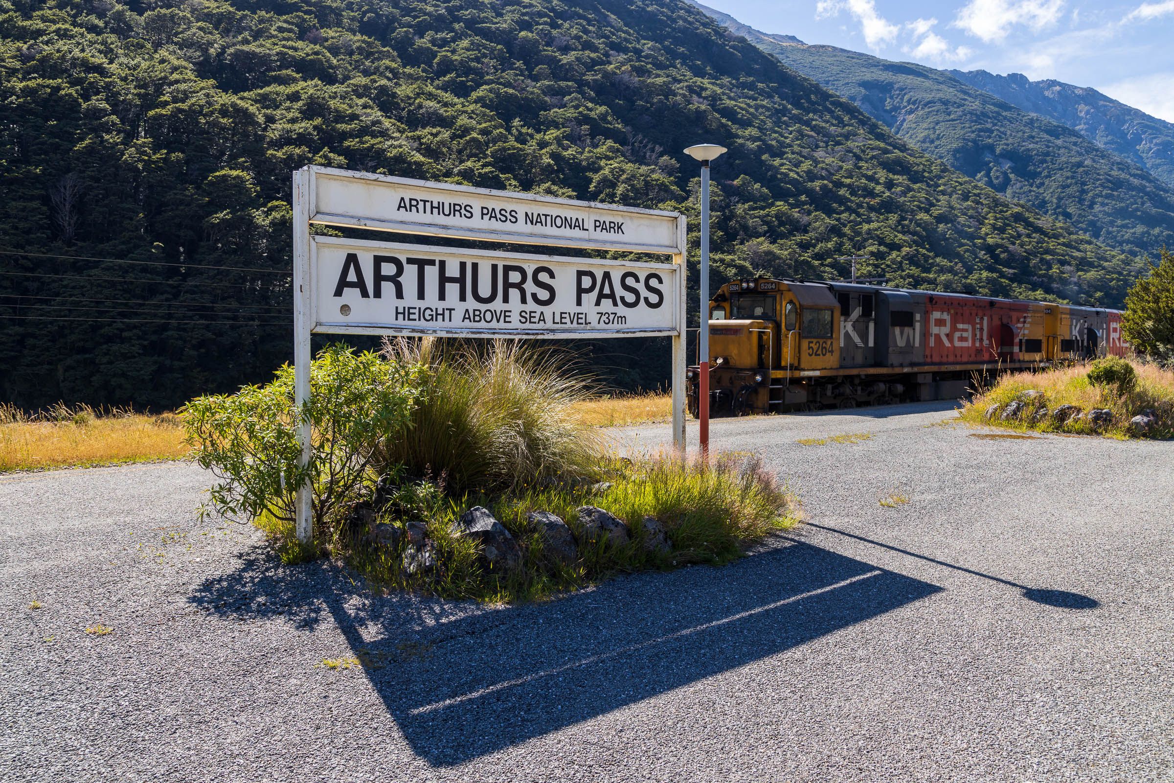
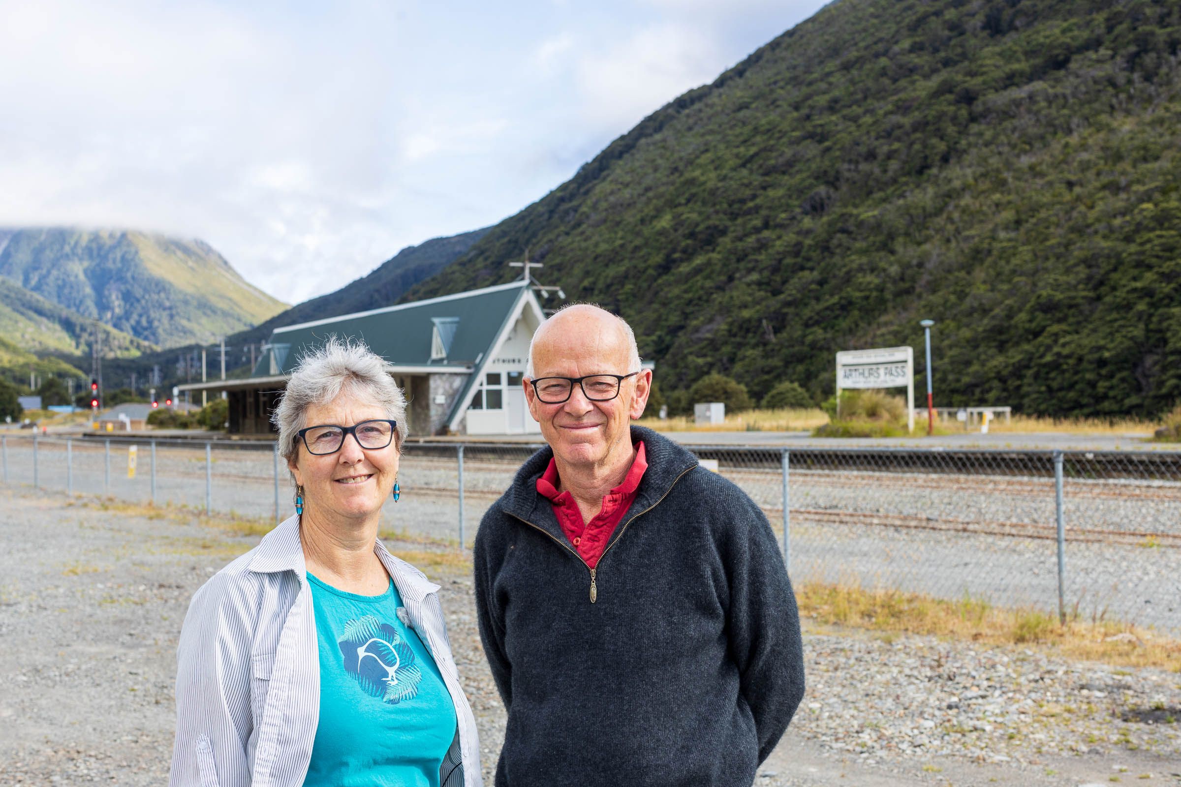
A few members of a Selwyn District Community Response team are gathered at the community centre at Arthur’s Pass Village. A woodburner is cranked up inside to combat the August cold. Chris Stewart is leader for the response team, alongside Fiona and Pete Neale, who own the local motel. Population of the village? “About 35. We’ll be okay. We’re used to being isolated,” says Stewart. “We’ve got generators, plenty of food, and good connections within the community.” They also have VHF radios and more than a few satellite phones.
“The risk,” Fiona Neale chips in, “is if the TranzAlpine train is anywhere near here when the fault ruptures. How to look after another 300 people? And then there’s the ski fields, that’s a biggie.” Stewart points out the few places that could hold large numbers of evacuees — the historic Outdoor Education lodge or the Department of Conservation Visitor Centre. (Ironically, both were — and remain — shut for earthquake strengthening and renovation.)
The risk of landslide here is low: slope stability has been assessed as favourable directly around the village. “But we’ll be cut off, in terms of the power and roads, from west or east,” says Stewart. “The Bealey Bridge might hold, but the approaches probably won’t.” Trampers and climbers will have to fend for themselves. “There’ll be PLBs pinging off in all directions. And not enough helicopters.” All three agree: “We’ll be fine. It’s the other side that we worry about.”


The other side is the Otira Gorge, about a 10 minute drive away. As Tom Wilson points out, one of the greatest risks of AF8 are those secondary hazards, the big one being landslides. These are young, unstable mountains. A landslide here could potentially dam a river, which would eventually burst and flood the area downstream.
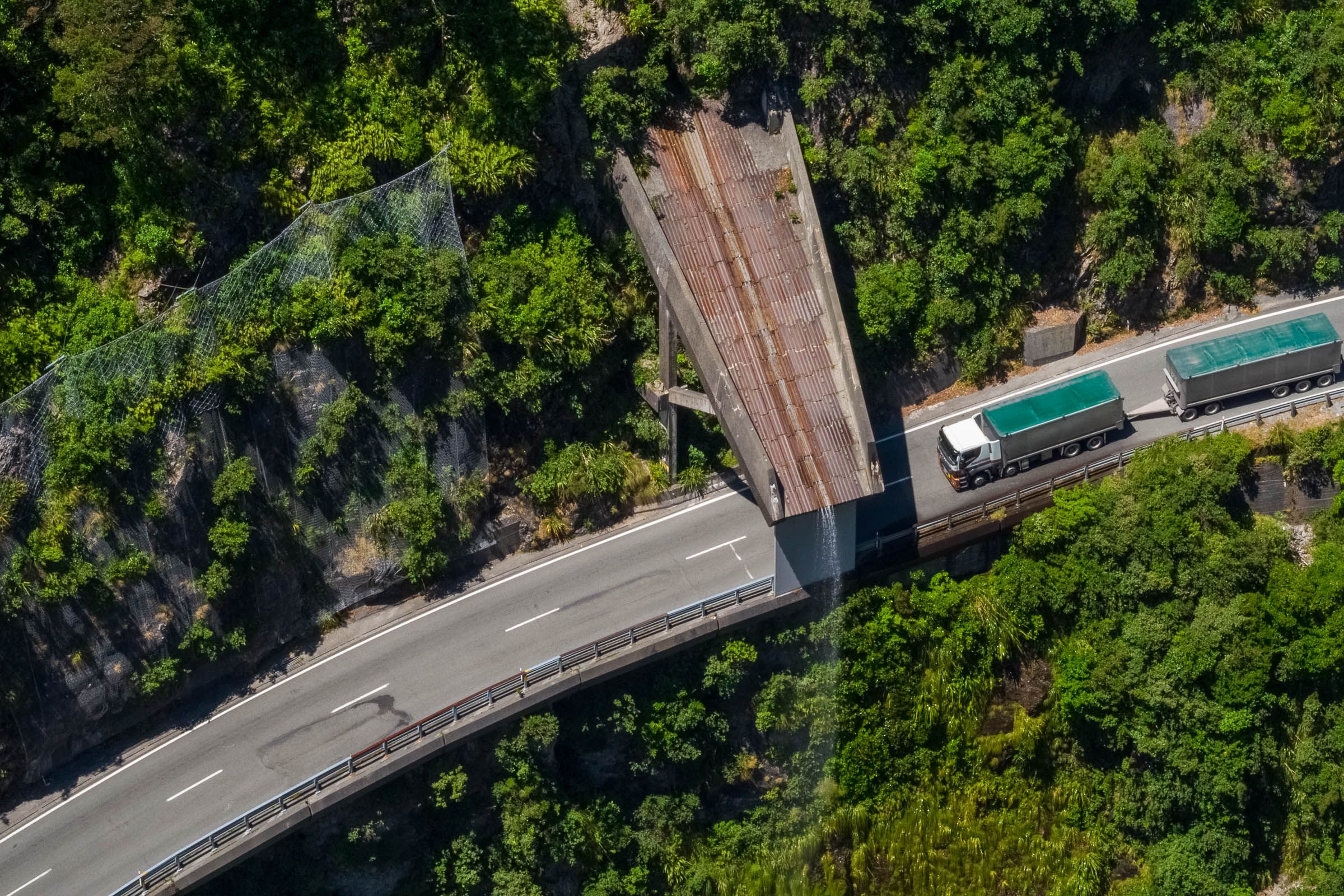
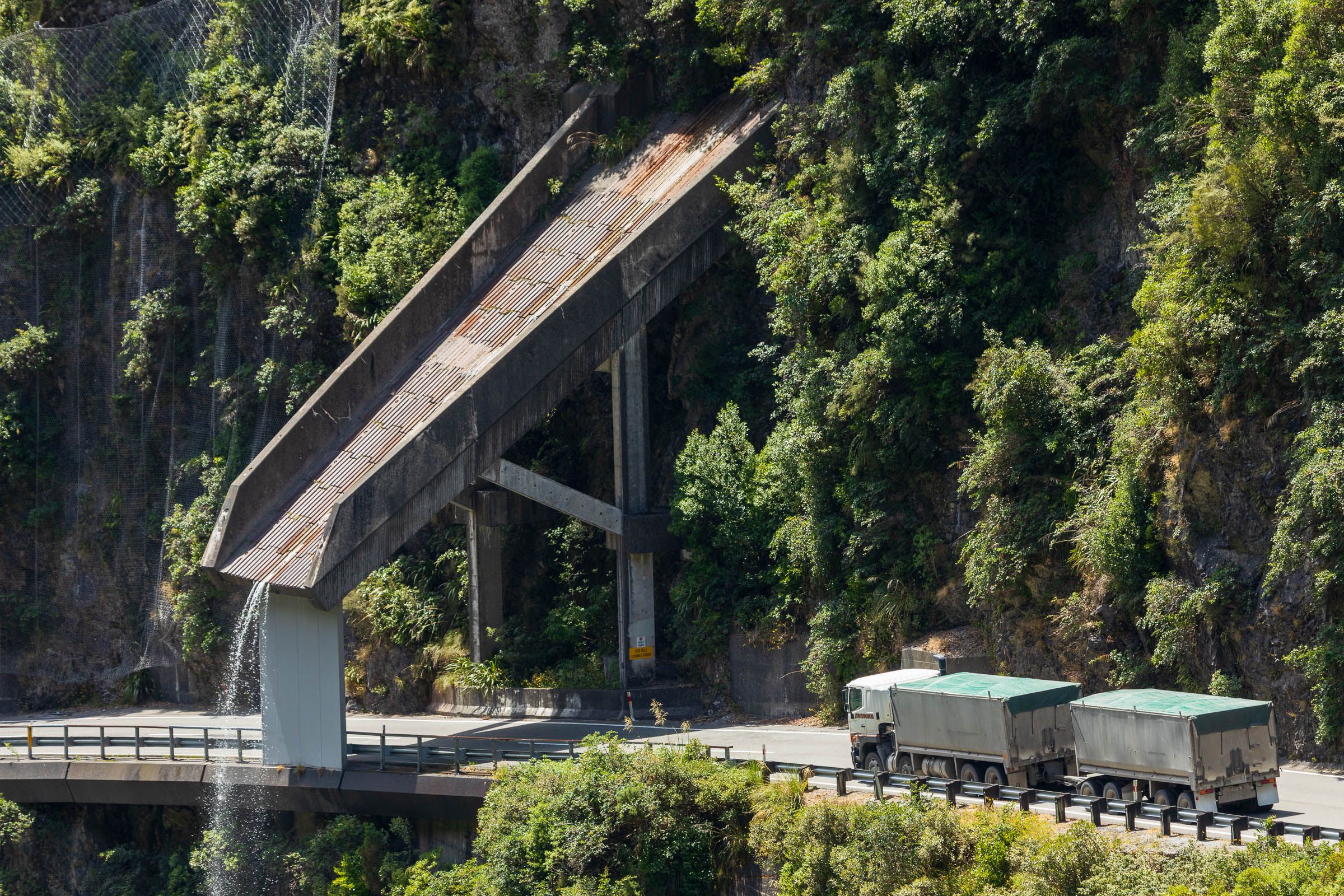
The turn-off viewing area at the Pass is ominously known as “Death’s Corner”. Barrier fences dissuade you from stepping too near the edge. A massive criss-crossed pylon looms above the parking area. Transpower’s Andrew Renton insists that the latticework of steel would be sufficiently strong in any seismic event. Wilson, however, predicts up to 30 pylons could be damaged through Arthur’s Pass and Otira in the event of an Alpine Fault event, and that it may well take over a year to restore power through to the West Coast.
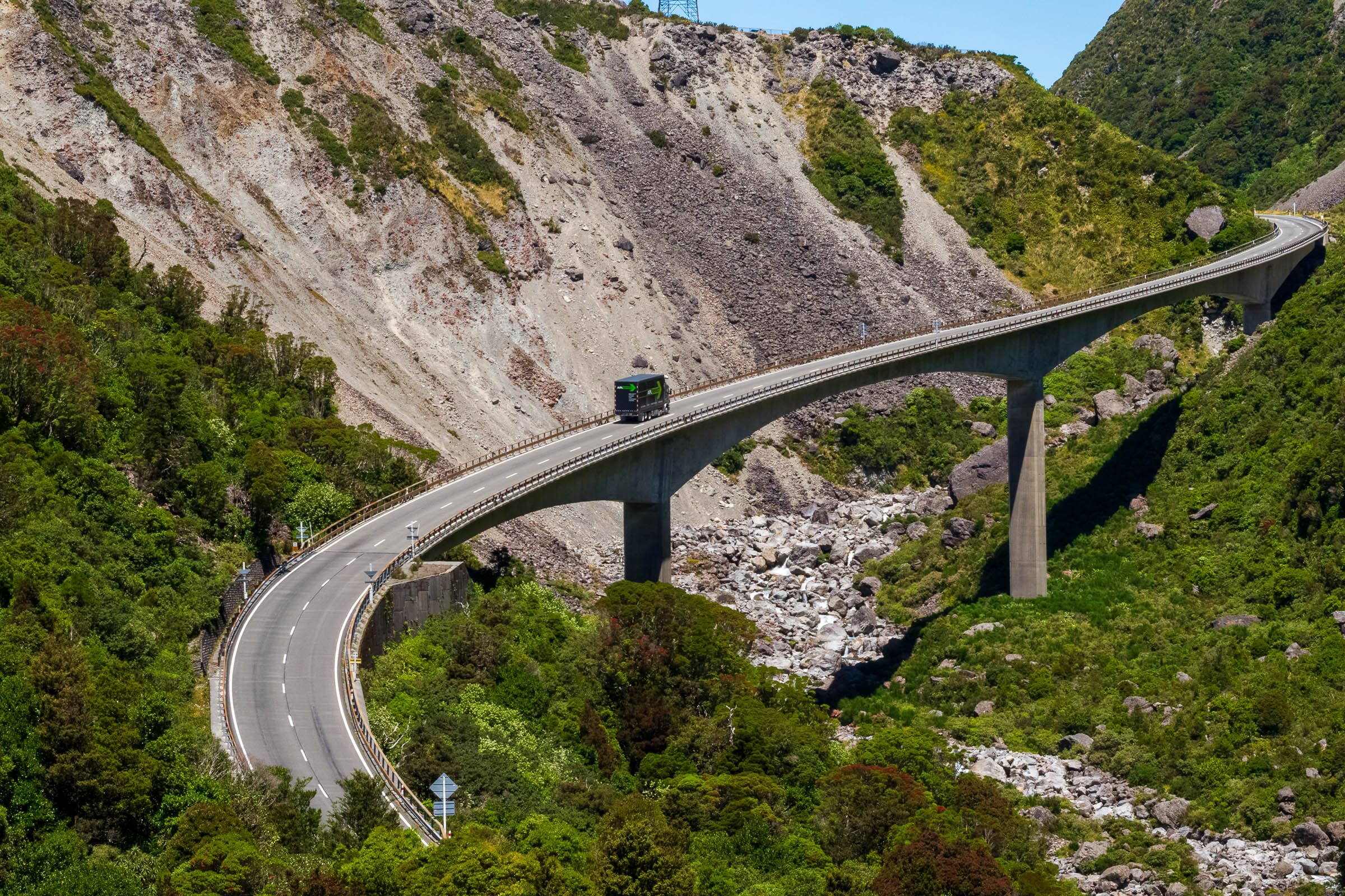
Keas dance along the barrier fence, framing the view down to the famous Otira Viaduct.
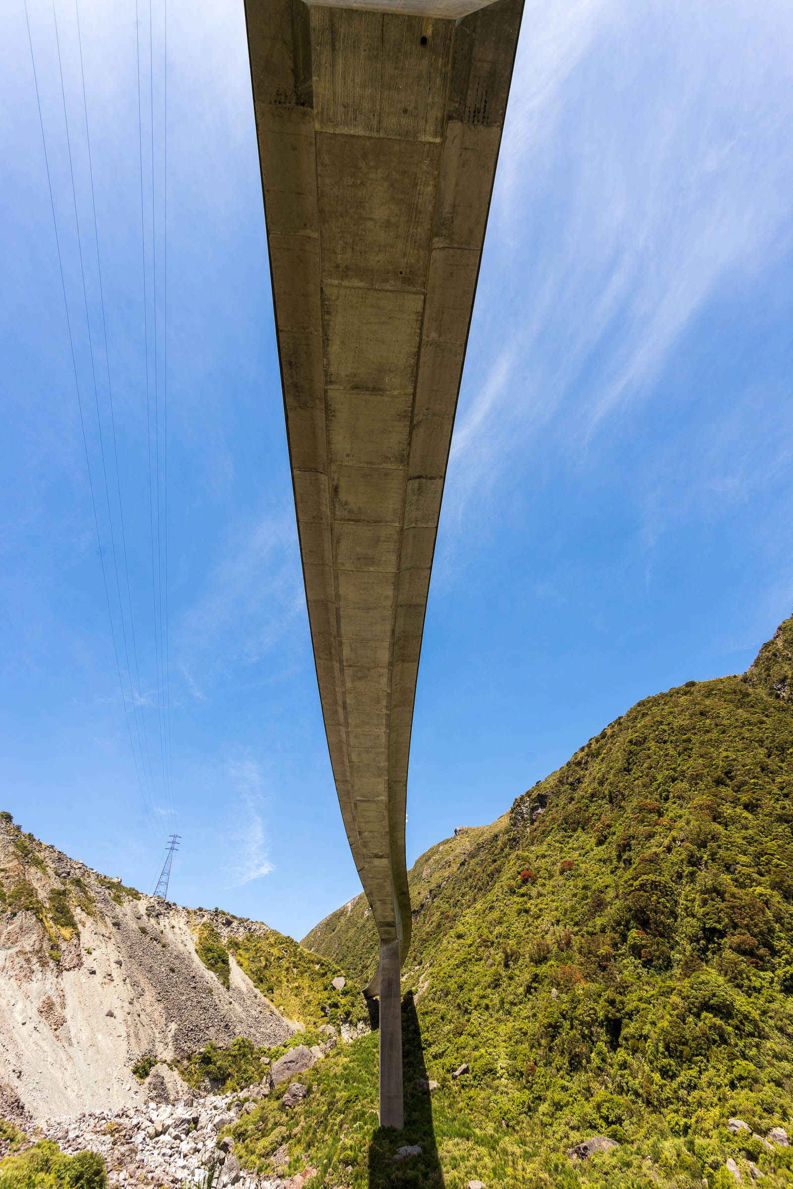
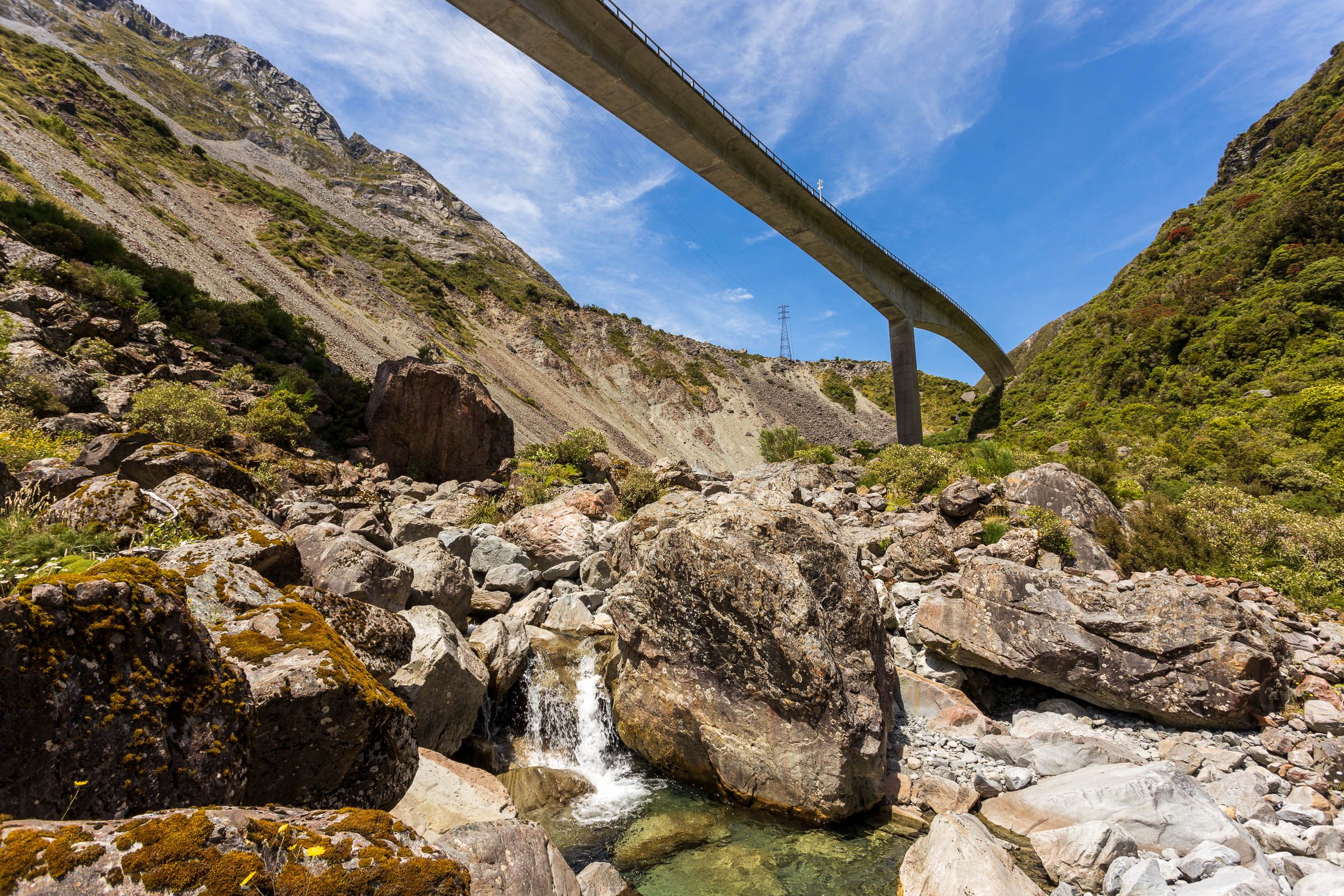
The 440-metre viaduct is a phenomenal piece of engineering, evidently built to withstand major earthquakes. But when estimating fatalities, the wild card is those black swan events — a large number of people in the wrong place at the wrong time. Although the viaduct might be resilient, the most obvious hazard is the terrain above. To the north is a giant, dynamic scree slope. The other side of the valley is steep, craggy rock. And further down from the viaduct, the road cuts into the cliff, wending and winding its way in brutal, precipitous terrain, often under rock overhangs.
One of three critical arterial routes to the West Coast, no one expects State Highway 73 to be open for several months after the Alpine Fault ruptures. There’s also an eight-kilometre rail tunnel beneath the mountains at Otira. It’s highly unlikely much of the TranzAlpine railway line will remain intact, and the integrity of the tunnel itself is anyone’s guess. “In Kaikōura, the landslides were only coming from one side of the railway line and road. Through Arthur’s Pass and Otira, it’ll get landslides coming down from both sides,” says Wilson. “With ongoing aftershocks and more landslides, it’ll make it dangerous to restore road or rail for months and potentially years.”
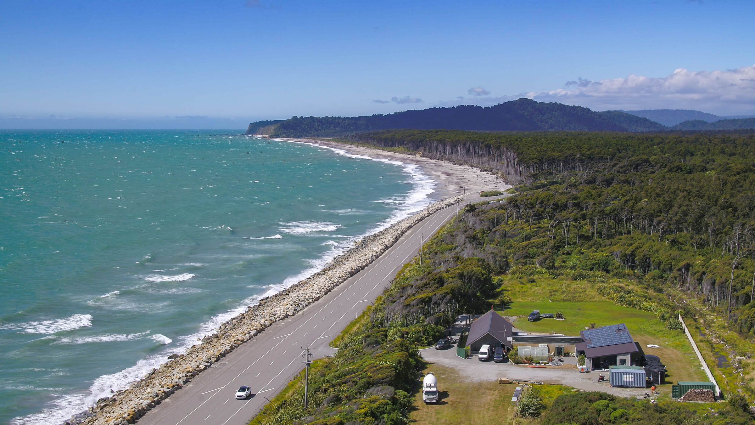
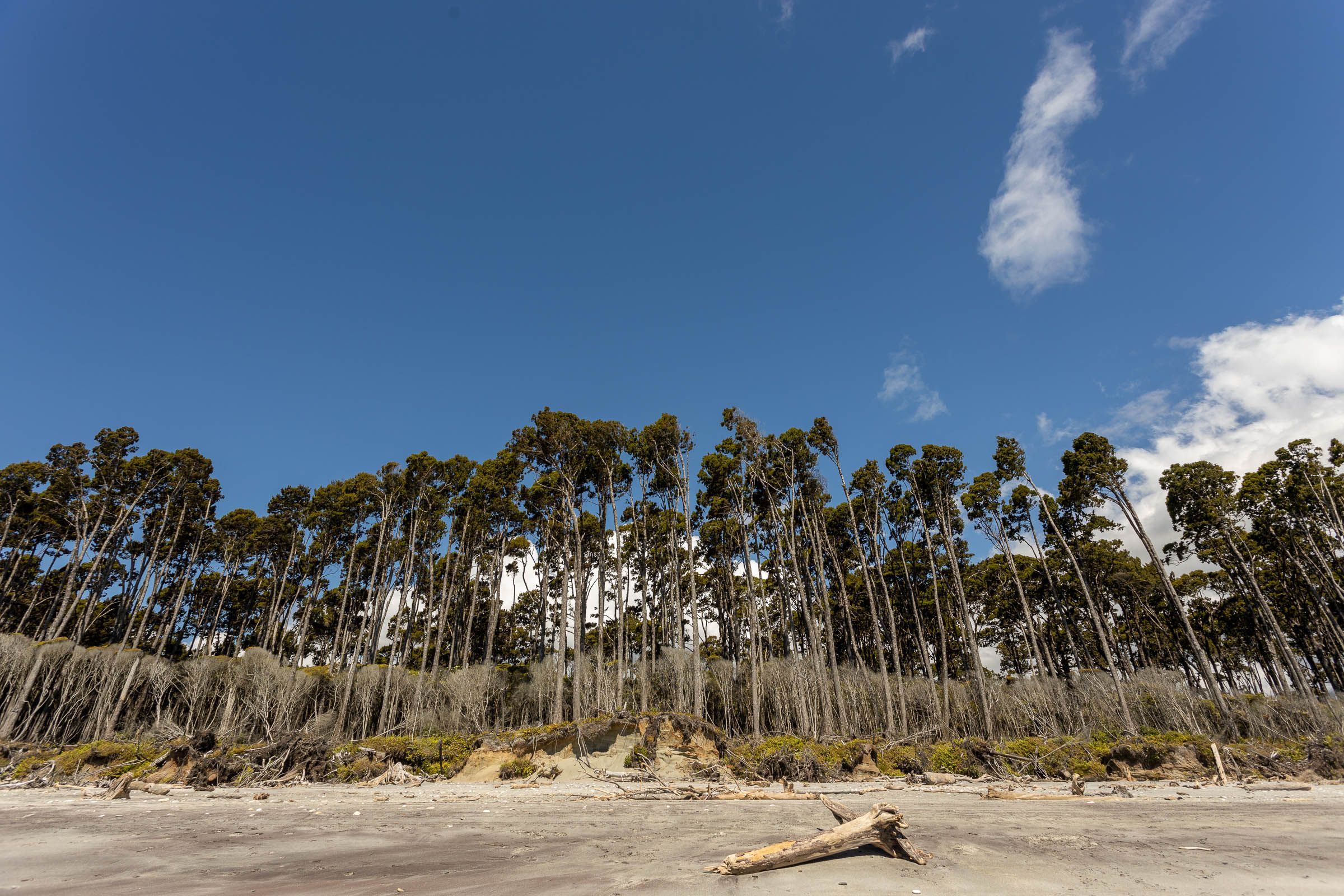
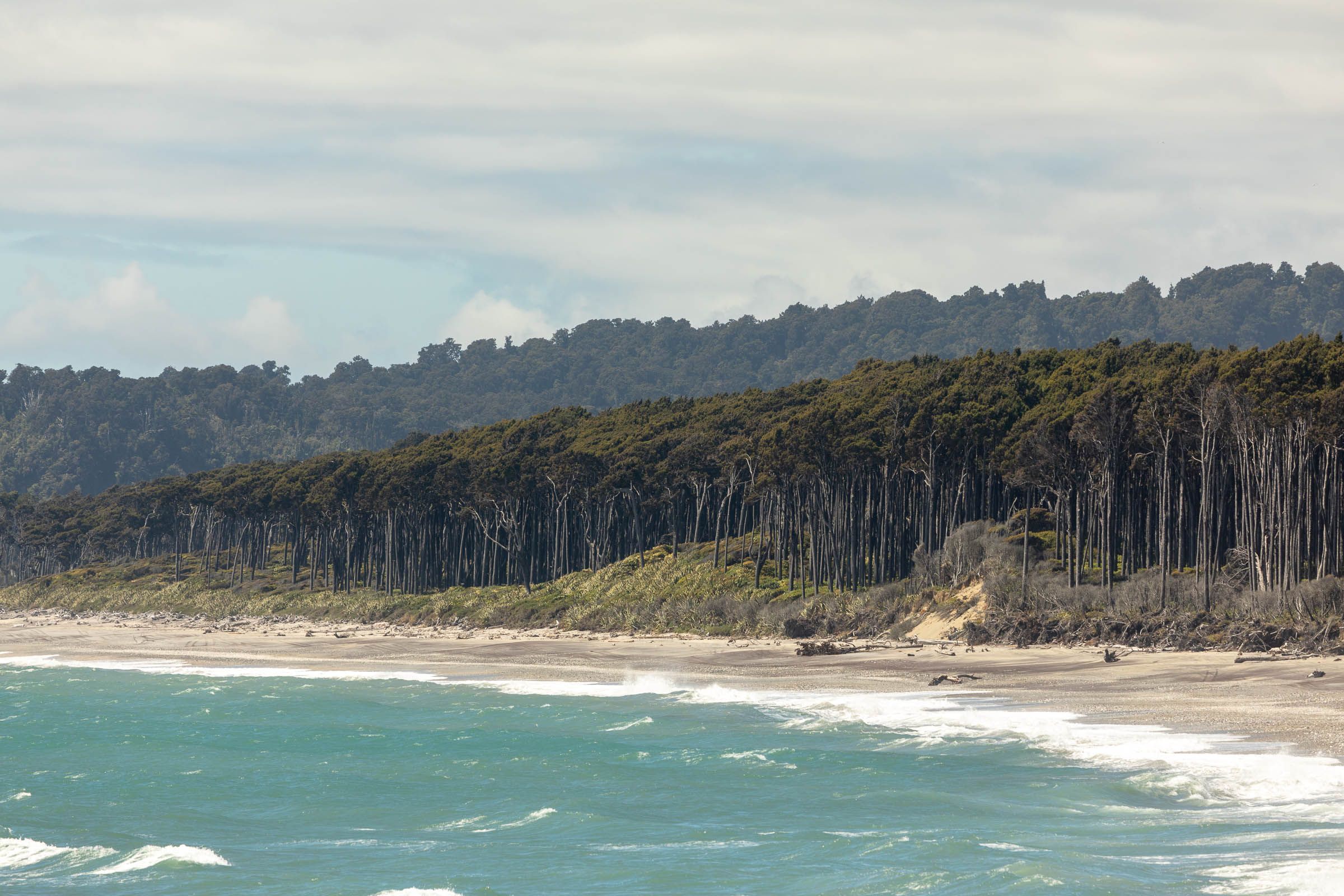
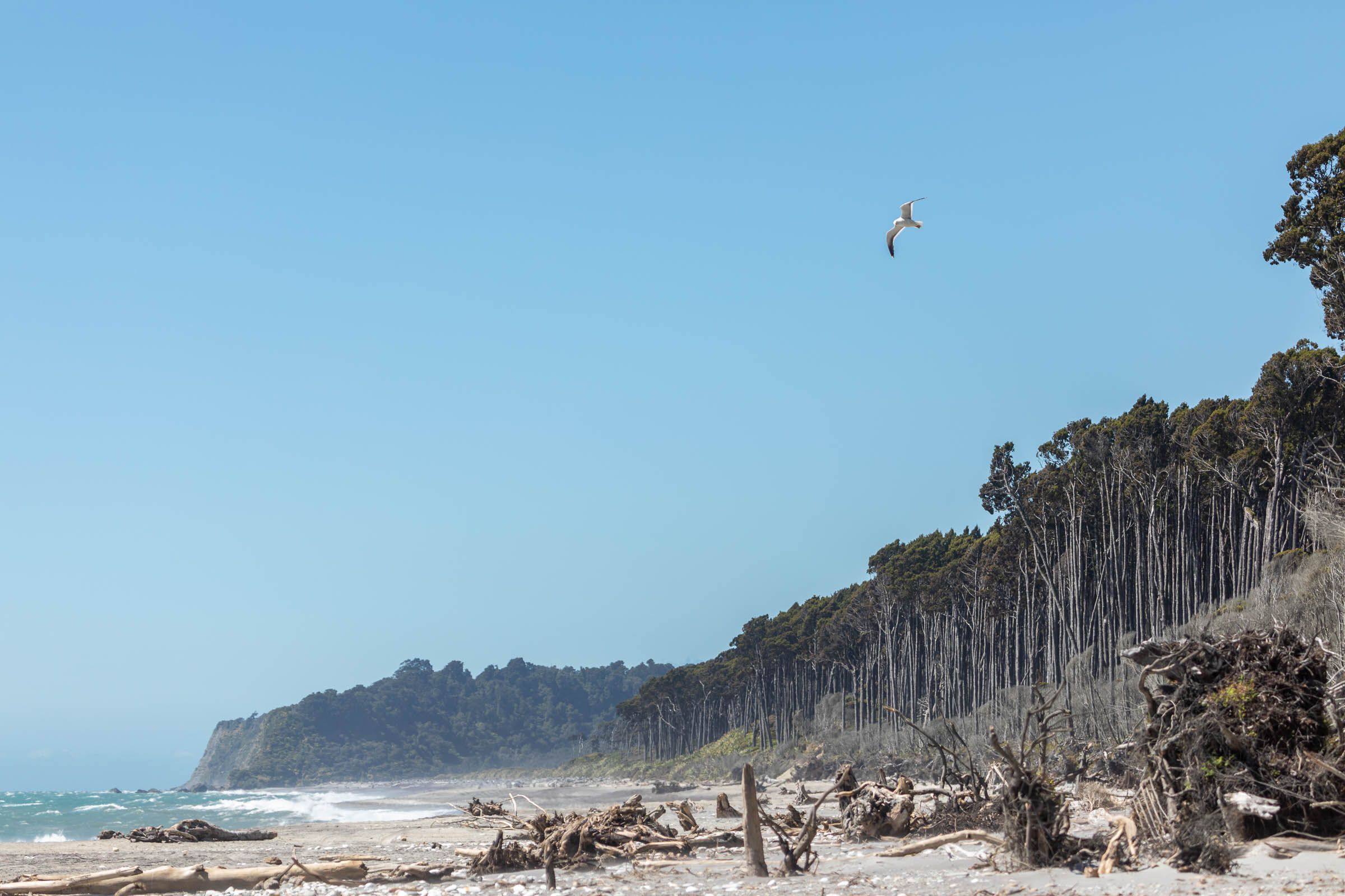
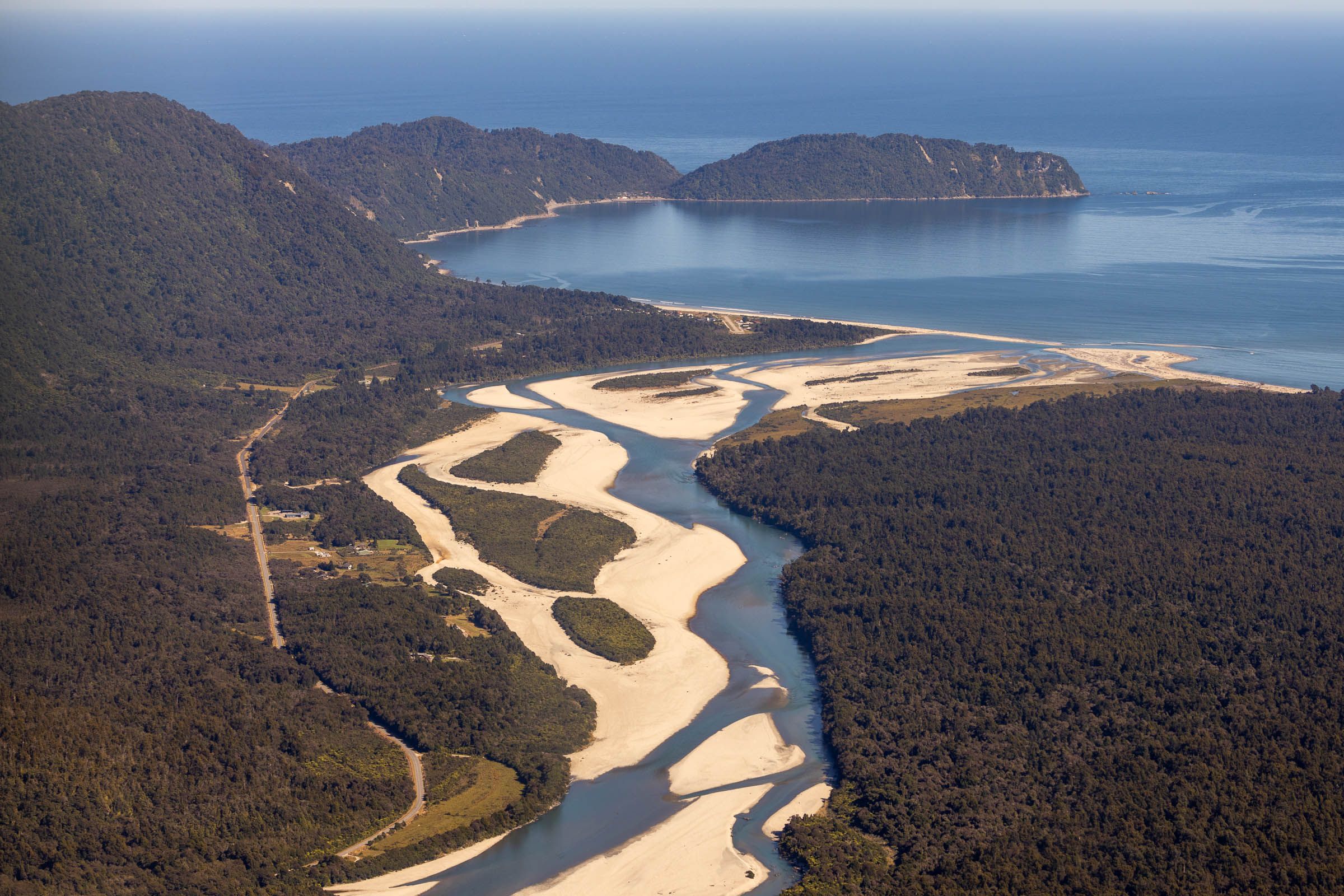
With all this in mind, it’s a relief to get to Kumara Junction, the valley widening, the contours of the landscape easing. Turn left, heading south down Te Tai o Poutini, the West Coast. Here, everything changes. The smell in the air, the haze from the Tasman Sea, the ponga and nīkau alongside the road. The sky is darkening, and the rain soon falls.
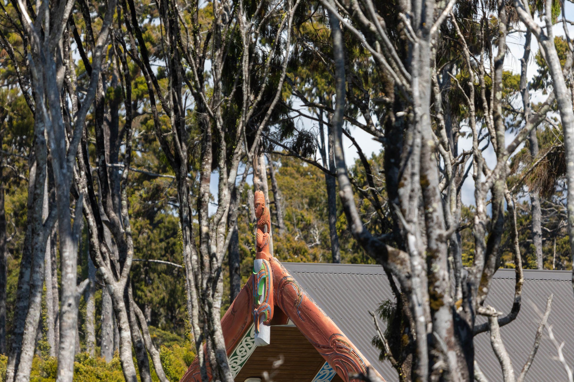
Rachel Forsyth, office manager for Te Rūnanga o Makaawhio — one of the many Ngāi Tahu rūnanga around the South Island — has the kettle on at their office on a Hokitika back street. She’s also the rūnanga’s Civil Defence representative. CEO Kara Edwards arrives five minutes later. The Makaawhio rūnanga extends from Hokitika south all the way to Whakatipu Waitai/Martins Bay in northern Fiordland, a stone’s throw from Hōkurī Creek. From across the Hokitika River here and extending north along the coast is Te Rūnanga o Ngāti Waewae. The members of these two rūnanga are dispersed, but kaimahi know where everyone is.


“We’ve got over 2500 members registered, and the grapevine’s pretty good, knowing who’s where, and who needs what,” Forsyth says. Preparations are under way, she says, adding, “Well, we’re Coasters. Often it’s a case of ‘Yeah, yeah, whatever’.” Civil Defence has installed a massive container near the airport, which will serve as headquarters and is slowly accumulating emergency food and equipment. Most of Hokitika is not far above sea level, but Seaview Lodge, an historic building that was once a mental hospital, sits on a terrace above the town and ocean and will be used for evacuations. The reality, Forsyth notes, is that every community down the coast will be isolated. “They’ll be cut off between every river, if each bridge goes down.”
From its central office in Ōtautahi/Christchurch, the Papatipu Rūnanga o Ngāi Tahu, which oversees all of Ngāi Tahu, now has a dedicated team for Whānau and Emergency Response. It was formed as a result of the Kaikōura earthquake when Ngāi Tahu moved in to help, not just their own people but anyone — Māori or Pākehā — who needed assistance.
Kara Edwards was on the ground at the Cheviot emergency base working on logistics for three weeks following the Kaikōura event. “We had Takahanga Marae in Kaikōura feeding and housing hundreds of people, not just locals but tourists, traumatised and with nowhere to go.” She smiles when she recalls the meals on offer at the marae kitchen: “They were being fed crayfish, pāua, all kinds of kaimoana — can you imagine?”
Ngāi Tahu chartered a helicopter, getting food in and people out to Cheviot, from where they boarded a bus to Christchurch. “We were ensuring the older people could get out to whānau or a marae in Christchurch,” says Edwards. “Many wouldn’t leave without their pets. We made sure their pets came too.” She describes an enormously complex spreadsheet of aircraft movements — who was going where, who could take whom. “It was a massive operation,” she says. “But we had the connections. We had the resources at each marae. We could do it.”
Before Kaikōura, the rūnanga was not officially invited to Civil Defence regional meetings. Jamie Ruwhiu, programme lead for Ngāi Tahu Whānau and Emergency Response, diplomatically suggests that this exclusion created tension and concern. Now Ngāi Tahu is both included and very active. Ruwhiu says the iwi will deploy its critical resources and networks on both the east and west coasts in the event of AF8. “We’re working with every marae,” he says, “ensuring they have all they need in the event of any emergency.”
Paul Madgwick, chair of Te Rūnanga o Makaawhio, has written extensively about the history and whakapapa of this area. At the time of the last quake on the fault line in 1717, Europeans had not yet arrived, but any kōrero handed down through generations of Māori is missing. Madgwick notes that the period “was a time of intense warfare on Te Tai o Poutini, as the invading Ngāi Tahu engaged the long-resident Ngāti Wairangi in a series of battles that would eventually lead to their complete subjugation.” Those who lived through the quake may have been killed or simply had other things to worry about. Still, Madgwick wonders why Ngāi Tahu hasn’t retained any knowledge of what would have been an unprecedented catastrophe. “It’s a mystery.”
Much of the road and many bridges south of Hokitika are well within that 10-kilometre mark. And most of the area’s rivers, taking their catchment from the massif of the Southern Alps, are big and fast-flowing. In the event of AF8, it’s likely the entire West Coast will be dissected by bridge failures and landslides, along with power and telecommunications.
The implications for people needing urgent medical care is daunting. There is one main hospital on the West Coast, the newly constructed Te Nīkau Grey Hospital and Health Centre in Greymouth. Fortunately, planners and architects designed a major component of the hospital with AF8 in mind. The integrated family health centre, which has triage and theatre facilities, was built to ‘importance level 4’ standards to withstand major seismic events.
There are smaller health centres in Reefton and Westport, and elsewhere towns are serviced by local medical centres. The difficulty will be getting wounded people there. Helicopters on the ground in the area could be damaged and inoperable. Any immediate aerial emergency response may have to come from the eastern side of the Main Divide. Those first moments of response and the many weeks thereafter will be enormously challenging.
But the response strategy developed by Civil Defence is reassuring. Each of the six South Island regions operates under a comprehensive emergency management plan that incorporates all the scientific input from AF8 under a framework known as SAFER — the South Island Alpine Fault Earthquake Response. Claire Brown, at the West Coast Regional Council, is the director of emergency management and natural hazards on the coast. She explains that a huge amount of work has been done in the past few years in terms of regional preparedness — the many Civil Defence teams taking part in exercises, the containers with emergency equipment and food stores installed in most towns and settlements. But the most important aspect is talking directly to communities.
“Household preparedness is the most important place to start,” says Brown. “For example, having an emergency water supply, enough for the household to have drinking water for at least three days. If every home on the coast did that one thing, we’d be hugely more prepared.”


Gray Eatwell meets me on the main road near Whataroa. It’s raining hard, the farm tracks wet and muddy. Before the pandemic, Gray and his wife Vicki Eatwell ran a company called Alpine Fault Tours, taking people up to see the fault. We drive in his high-wheel-base vehicle off-road up Gaunt Creek. There’s a deep fault drilling site on the side of the river where geotechnical equipment relays temperature readings to scientists around the world from almost 100 metres down.
The river’s too high to cross, but you can easily see the slip-strike zone, where the Pacific tectonic plate quite literally grinds up against the Australian plate. It’s marked by a pale but distinctive green rock angling up the escarpment at 45 degrees. Eatwell picks up a few of the green rocks around our feet. “Cataclasite is what it’s called,” he says. “The intense pressure along the fault line reduces it to this fine-grained rock.”
The Alpine Fault wasn’t always obvious. The northern section was vaguely identified as far back as the late 1920s. But it wasn’t until the early 1940s that its full extent was worked out by geologist Harold Wellman, who then named it the Alpine Fault. He walked much of it, including the ‘tiger country’ terrain from north of Milford Sound and up Hōkurī Creek. Wellman was audacious enough to suggest that the two sides of the South Island had moved over 480 kilometres along the fault line, although he assumed the plates were moving “incrementally”, at around 2.5 centimetres a year. It would be several decades before his students discovered that the slip-strike movement resulted from 8-metre shifts caused by major quakes occurring every few hundred years.
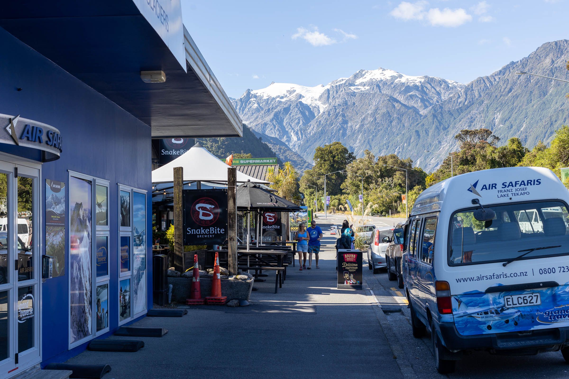
Today, satellite photographs show the Alpine Fault clearly. (Wellman must have been delighted to see these images, produced before he died in 1999.) The fault line nestles within the contours of the base of the Southern Alps along most of the West Coast. But now and then it crosses roads and towns. The most obvious is Franz Josef, where the fault literally divides the town. The fire station and churches are on one side; the main part of the township on the other. At Glacier Motors, the fuel tanks straddle the fault line.
Tim Gibb, head of the Community Response team, is a fifth-generation local. His great-great-grandfather mined for gold at the Three Mile settlement south of Ōkārito from 1868. Gibb gained notoriety in the March 2019 floods when the Waiho Bridge was washed away — he cranked up a massive truck to take vehicles across the river. “Got a bit of a rap on the knuckles for that,” he says with a grin.
They’re under onslaught here, from the fault line but also from the river. The Waiho River now runs barely several metres away from the altar of St James’ Anglican Church. Stopbanks have repeatedly failed. There is a proposal to divert the river south, but it would mean buying up farmland at a cost of over $22 million. The decision-making between West Coast Regional Council and the Department of Internal Affairs seems to have stalled.


Gibb works alongside Wayne Costello, the Department of Conservation operations manager for South Westland, on the Community Response team at Franz. They admit they’d love someone to put up the funds to move the fire station. “The Fire Service talked about building a new station,” says Costello, “but that was before the Christchurch earthquake. We’re still waiting.” Most of the team lives on the other side of the fault line from the fire station. “Be a bugger if you simply couldn’t get to your emergency equipment,” Gibb suggests wryly.
Another obvious concern is those fuel tanks. “The earthquake would rupture the tanks,” Costello says bluntly. “We’d have fuel running into the stormwater drains. Then all it would take is one strike of a match.”
Bruce Smith, mayor of Westland District, says the council has sought funds from FENZ to move the fire station. It’s also in close communication with the National Emergency Management Agency (NEMA). The district council has a few items on its wish list, a major one being the installation of massive diesel tanks in Greymouth. “We’re going to need the fuel for all the excavators,” Smith says, “to clear landslides and river banks.”
But that doesn’t quite solve the issues in Franz Josef. In 2017, GNS Science commissioned Tonkin + Taylor and Ernst & Young environmental consultants to investigate the risks of both the Alpine Fault and the Waiho River and offer solutions. In addition to the proposal to divert the river south, the report strongly recommended moving the entire township 10 kilometres north up the road. Which went down here like a load of schist. No one wants to leave Franz. Many residents, like Gibb, have been here their whole lives.
Wayne Costello is one of them. He lives in one of six DOC houses built bang on the fault line. Even though he knows more than most about the dangers of AF8, he is still reluctant to leave. And he’s getting tired of the constant calls for the whole town to be moved well away.
“We’re not going to let the threat of the fault undermine our lifestyle,” he says. “It’s a terrific community. And look around — it’s stunningly beautiful. That’s why we live here.”
Caroline Orchiston understands people’s reluctance. But, she insists, government funds would be well spent ahead of time to mitigate potential damage. “A dollar spent now could well save five dollars after the event, and a good many lives,” she says.
But the buck stops where? There is, unfortunately, no obvious source of funds. NEMA provides “support, advice and coordination”. The agency has suggested that local councils should provide financial support for anything from satellite phones to moving fuel stations. But with such a small rateable population base on the West Coast — just over 32,000 residents and almost 14,000 dwellings — that’s unlikely.
NEMA has, however, has helped fund AF8 since its inception as well as funding a $90,000 Action Plan to support a “West Coast Resilience Strategy”. In May, the Minister for Emergency Management Kiri Allan also announced $340,000 in funding to the West Coast for two “Preparing for AF8” projects. This funding is to enable better access to emergency fuel and power, and to strengthen emergency communications.
When queried about the hazard represented by the Franz Josef fuel station, Anthony Frith, communications manager for NEMA, said in an email that “petroleum fuel operators have obligations to ensure that it is able to function to the fullest possible extent even though this may be at a reduced level, during and after an emergency”. He goes on: “As such . . . it is incumbent on the operator to determine how to best meet these responsibilities.”
Sea level rise, the increase in the frequency and strength of storm events, and tectonic plate movements — these are beautiful, but precarious places to live. Fortunately, most scientists agree that the risk of a oceanic tsunami from AF8 is low. The Alpine Fault is on land here, not out to sea.
I pause to grab lunch at the local store in Haast. It’s run by Nicky Harris, a cousin of Kara Edwards (the connections and whānau grapevine up and down the coast really do work wonders). Between making eggs on toast for the two campervan tourists in town, she’s dismissive of the talk about AF8, telling me, with a shrug, “We’ve been through it all already.”
She’s referring to Cyclone Fehi in February 2018. She was worried sick about her Mum and Dad up the coast who lost their home. The road immediately to the north was closed by a massive slip, and the road through Haast Pass was washed out too. She and other locals had to find food and shelter for more than 2000 tourists trapped in town. “So we’re used to it, storms, floods, slips, earthquakes.”
They did realise how dangerous it was that Haast School is located several kilometres out of town at Hannah’s Clearing, two bridges and two reasonable-sized rivers away. “It was so windy we couldn’t use the high-sided school van — it would have blown over,” she says. “So we sent a couple of the boys with four-wheel-drive vehicles to get the kids out. Fortunately the rivers were okay.”
When I ask her about community preparations, she chuckles resignedly. “Yeah, they’re talking about a container going in, with a few supplies.” She goes on to mention the Provincial Growth Fund, some of which has been has been allocated to the restoration of the Jackson Bay Wharf, the only deep-water port on the West Coast. “Perhaps one option after the earthquake is for a ship to come in and land supplies. But have you seen the road to Jackson’s?”
She’s right. The road to the furthest point on State Highway 6 at Jackson Bay is not dissimilar to the road all along the West Coast, one section of roadworks restoring the surface below a muddy slip followed by another.
It’s daunting to consider how communities will cope, not just in the immediate aftermath, but in the months and years that follow. If it takes up to six months or longer to repair Arthurs Pass, Haast Pass, Buller Gorge and the many bridges up and down the coast, will many of the people living on Te Tai o Poutini simply have to go elsewhere?


The sustainability of West Coast communities is of huge concern to Dr Caroline Orchiston. “People are deeply connected to that landscape. They won’t want to leave but I think there’s potentially a tipping point where the government will say, ‘we can’t restore services, we can’t get the power network back, you’re going to have to, temporarily let’s hope, move out.’” And if that happens, she asks: “Do people go back?”
The aftermath of the Christchurch earthquake shows how reluctant people are to move away, she observes. “No one wanted to leave their home and go into temporary housing. Even if their house was munted they’d prefer to camp in their garden than leave,” she says. “They have a really deep connection to that place. You constantly wonder about community resilience — what’s the turning point? How do we prioritise recovery of infrastructure to enable people to stay in place?”
Westland District chief executive Simon Bastion is adamant Coasters are a resilient lot but there is only so far that can go.
He says they could handle three to six weeks isolated. “But then we would find constraints in the supply chain, looking after our residents and getting supplies to those critical areas.”


I have a final destination in mind, even further south, up the Arawhata River Valley to Lake Ellery. Between 2011 and 2013, it was visited on successive research trips by Victoria University scientist Dr Jamie Howarth, who took core samples of the sediments from lakes all the way down the coast of the South Island — Kaniere, Mapourika, Paringa and finally Ellery.
There’s a track up the side of the Ellery Creek, off the gravel road. The walking track follows the creek, and today it’s quiet (not a lot of bird life, another sad story), but the reflections and green of the river, the forest hanging low over the water, are magnificent. Howarth and colleagues made repeated trips up the creek, carrying and towing every piece of equipment — dinghies, coring equipment, compressors. Not only does Howarth have one of those brilliant and slightly intimidating scientific brains, but he has a tenacity and a passion for the science of the Alpine Fault to rival his predecessor, Harold Wellman.
At every lake, from every core of sediment, Howarth discovered a similar story to that which scientists had found at Hōkurī Creek. At the point of time of every earthquake, the sediments on the side of the lakes had shifted, along with sediments from surrounding landslides, so that when he opened each core sample Howarth could count the events, one by one, over several thousand years. What he discovered was critical: the frequency of the events was increased: In some sections, the fault line would rupture, on average, every 250 years, not 300 years. But he also discovered that not all of the fault ruptures every time. There are sections that might not move, and “gates”, as Howarth describes them, that could inhibit the passage of a rupture. But overall, the odds of a quake have gone up, not down. From a 30 per cent likelihood in the next 50 years, we now have a 75 per cent likelihood. If those were your chances at winning Lotto, you’d buy a ticket every week.
The view finally opens up — Lake Ellery. It’s tucked away, a hidden jewel. The dense podocarp forest meets the lake and coats every slope of hill and mountain above the water in deep green. The lake itself is mirror calm, like sheet metal in the winter sun. It’s gobsmackingly beautiful.


There’s a cold front forecast to move in the next morning, with snow to low levels. I fuel up at Haast Beach Motors and make the slow trip home through Haast Pass. The light fades as I navigate the corners past the Landsborough Valley, white peaks edging up towards the massif around Aoraki, the mountains tinted a shade of rose-pink in the evening glow. Mist rises up off the river flats. I wouldn’t want to live anywhere else in the world but here — this whenua ātaahua, beautiful because of that line in the earth, our Alpine Fault.
An Alpine Fault earthquake will release an immense amount of energy.
For comparison the Christchurch earthquake of 2011 was of a 6.3 magnitude.
An Alpine Fault magnitude 8 rupture will be exponentially bigger - releasing 350 times more energy.
Not only that, but the shaking will be long.
Christchurch, February 2011, was around 30 seconds. This one could last for two to three, maybe even four minutes.
Not only that, but the shaking will be long.
6.3 magnitude
8 magnitude
0.5 minutes
3 minutes
An Alpine Fault earthquake won't just hurt the West Coast...
...It connects to a network of faultlines